Ojai has a reputation as being the Shang-ri-la of Ventura County. With its old mission style architecture, and its laid back atmosphere, it is a mecca for artists of all persuasions. With a mild Mediterranean climate all year round, the California coast nearby, and challenging climbs in multiple directions, Ojai is truly a city for cyclists, and we are proud to be part of carrying on that tradition. New this year, the 4 mile section down the coast into Ventura on the Hwy 101 bike lane has recently added K-rail concrete barriers to completely separate bikes and freeway traffic!
Open All Routes in Ride with GPS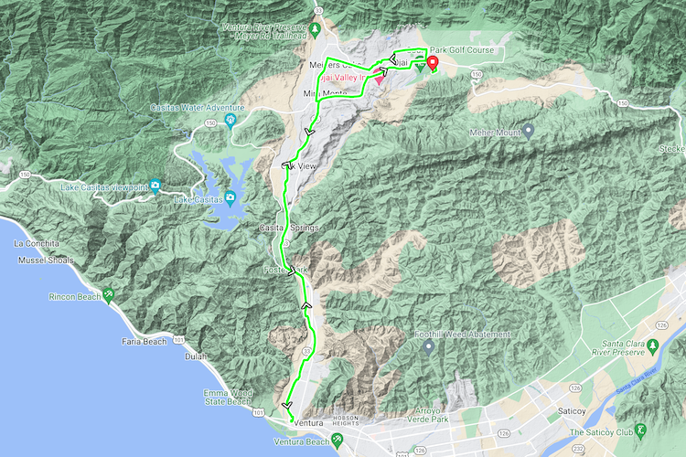
The Half Century is best for beginning riders who are not quite ready for a metric century or longer ride. The ride starts and finishes at the Soule County Park, and follows the scenic Ojai Bike Trail along the Ventura River to the Patagonia SAG stop in downtown Ventura before returning to Ojai. This route has a gentle 1% grade with a total elevation gain of 1,200 feet.

Gravel Grind Ventura River Preserve
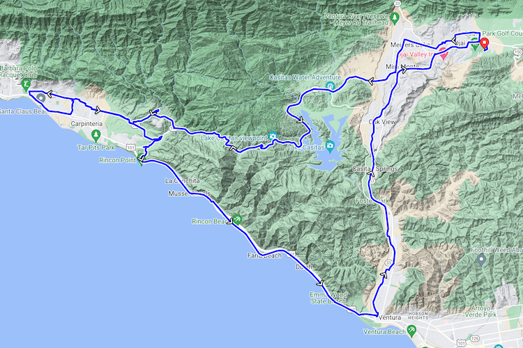
The Metric Century leaves the Soule County Park heading west over Casitas Pass, which is the one major climb on the metric route. This climb is about 4.5 miles long and is mostly about a 5% grade with a few steeper sections. From there the route heads out to Carpinteria and then down the coast to Ventura. From Ventura the route heads up a very gradual grade back into Ojai via the Ojai Bike Trail. The estimated maximum elevation is approximately 1,200 feet, while the total elevation gain is about 3,400 feet.
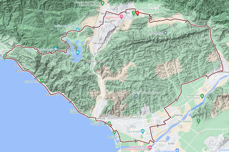
The Full Century heads west over Casitas Pass over many of the same roads used by the Amgen Tour of California. The ride continues on through Carpinteria, Montecito and Summerland before heading south along the coast to Ventura and eventually Santa Paula where you will connect with highway 150 to upper Ojai and down the twisty Dennison Grade back into town. The max elevation is approx 1,600 feet, while the total elevation gain is approximately 5,300 ft.
The OVC bike ride travels through permitted areas of the National Forest. The USFS provides management and authorizations for use. Under Special Use Permit by United States Forest Service